Welcome to the Planet Earth unit! This guide covers essential...
Earth Science Vocabulary Definitions
Donna Costanz@donnacostanz_bbnm


1 / 6
1
of 6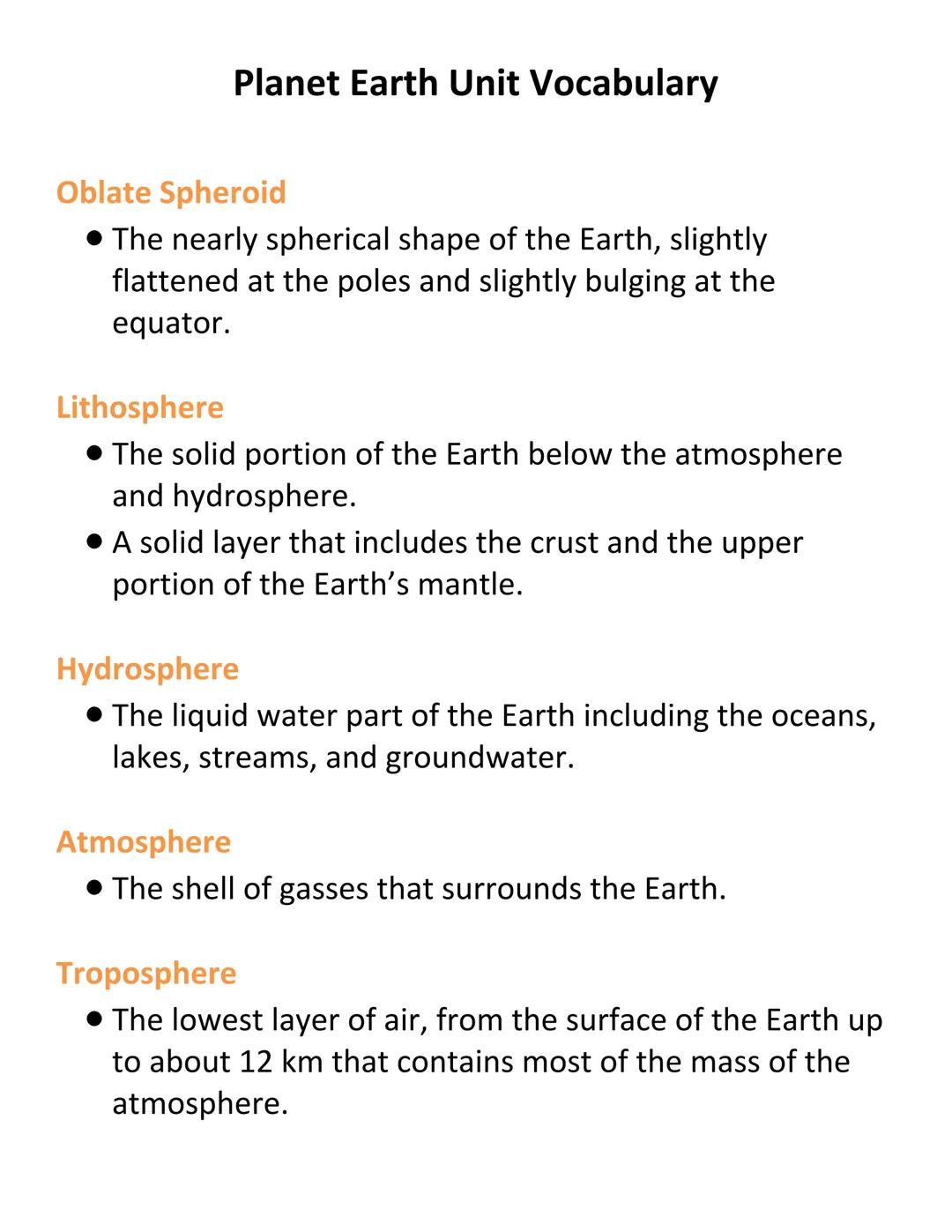
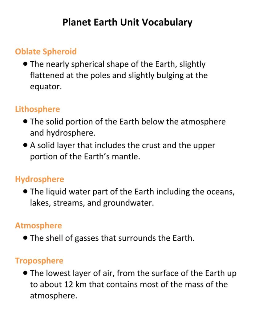
Earth's Structure
Earth isn't a perfect sphere—it's an oblate spheroid, which means it's slightly flattened at the poles and bulges at the equator. Our planet is made up of several major layers that work together as a system.
The lithosphere is the solid outer shell of Earth, including the crust and upper mantle. The hydrosphere covers all of Earth's liquid water—oceans, lakes, rivers, and even groundwater.
Surrounding everything is the atmosphere, the layer of gases enveloping our planet. The lowest layer of the atmosphere is the troposphere, which extends about 12 km up from Earth's surface and contains most of our air and weather.
Fun Fact: The troposphere contains about 75-80% of the atmosphere's total mass, despite being the thinnest atmospheric layer!
2
of 6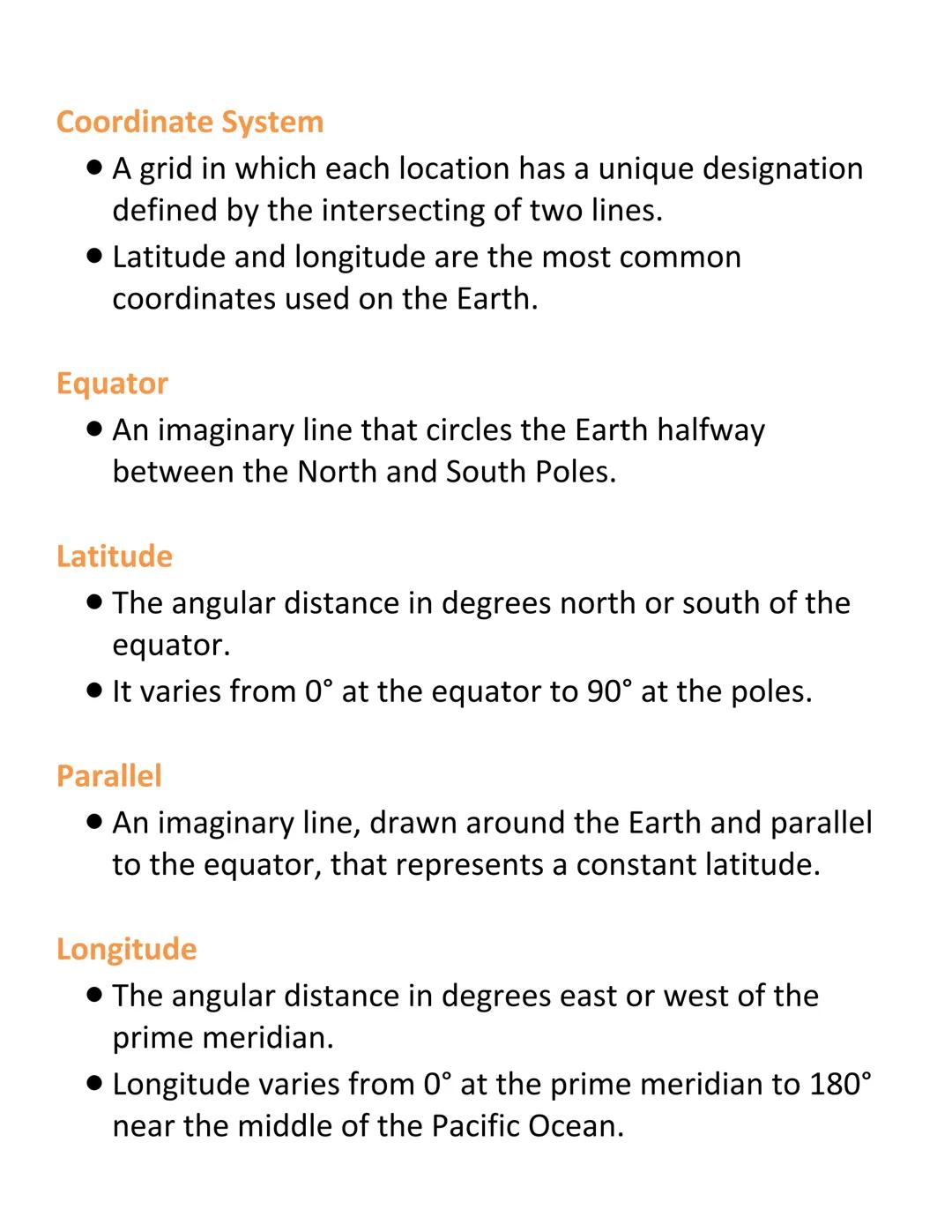
Mapping Earth: Coordinate Systems
Imagine wrapping Earth in a giant grid—that's essentially what a coordinate system does! It gives every location a unique address using the intersection of two lines, typically latitude and longitude.
The equator is the imaginary line circling Earth halfway between the North and South Poles, dividing our planet into northern and southern hemispheres. Latitude measures the angular distance north or south of the equator, from 0° at the equator to 90° at the poles. Lines of the same latitude are called parallels.
Longitude measures east or west of the Prime Meridian (which runs through Greenwich, England), ranging from 0° to 180°. These imaginary semicircles running north-to-south are called meridians.
Remember this: Latitude lines (parallels) run east-west, while longitude lines (meridians) run north-south. Think "latitude is flat-itude" to help remember!
3
of 6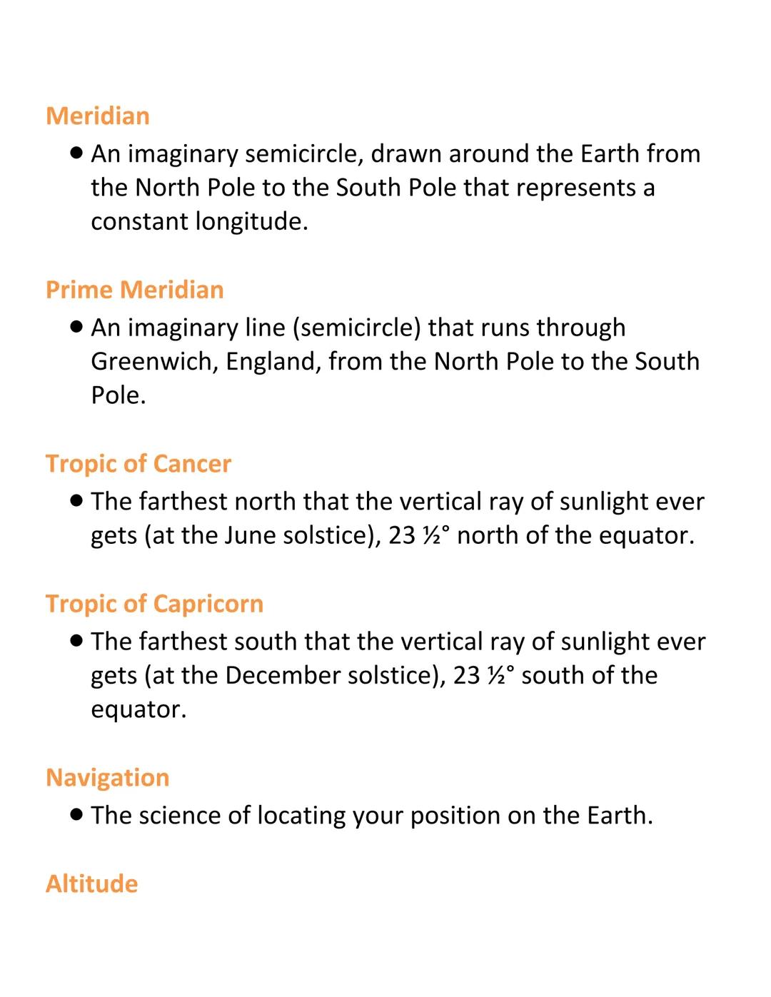
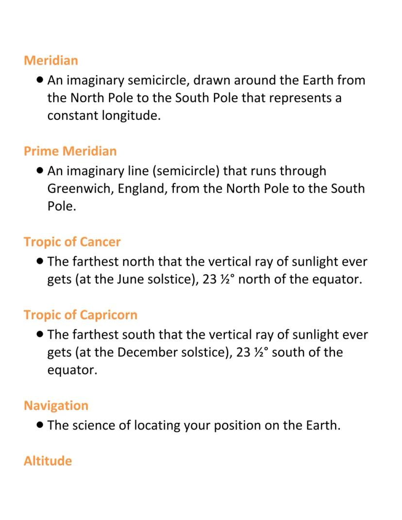
Special Lines and Navigation
The sun's position creates some important reference lines on Earth. The Tropic of Cancer (23½° north) marks the northernmost point where the sun's rays hit directly overhead during the June solstice. Similarly, the Tropic of Capricorn (23½° south) marks where direct sunlight reaches its southernmost point during the December solstice.
Navigation is how we determine our position on Earth. One navigational measurement is altitude, which tells us how high an object appears above the horizon from our viewpoint.
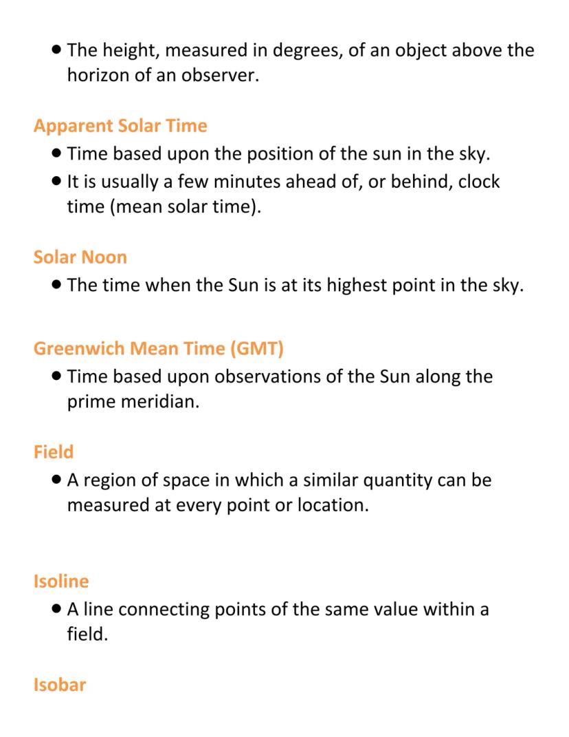
Time measurement is also connected to Earth's geography. Apparent Solar Time is based on the sun's actual position in the sky and varies slightly from clock time. Solar noon occurs when the sun reaches its highest point in your local sky.
Try this: Next sunny day, notice the sun's position at different times. At solar noon, objects cast their shortest shadow of the day!
4
of 6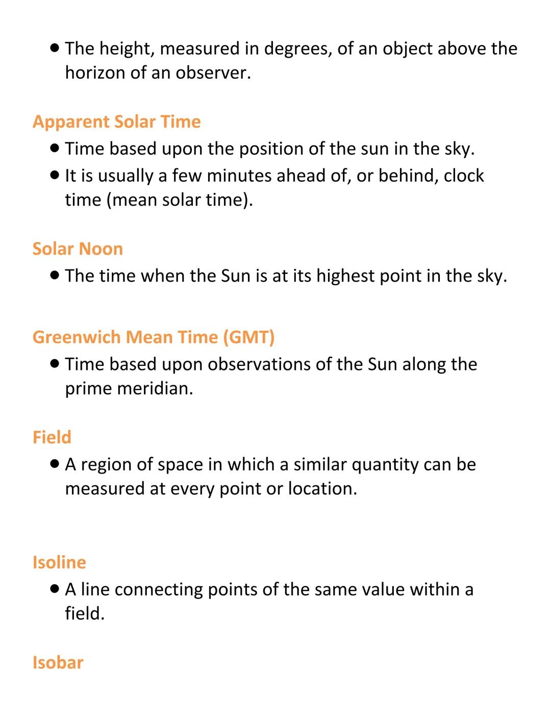
Time and Fields
Greenwich Mean Time (GMT) is based on solar observations along the Prime Meridian, providing a standard reference point for global timekeeping.
When studying Earth, scientists often work with fields—regions where we can measure similar quantities (like temperature or pressure) at every location. To visualize these fields on maps, we use isolines, which connect points of equal value.
Specific types of isolines include isobars (connecting points of equal air pressure) and isotherms (connecting points of equal temperature). These help meteorologists track and predict weather patterns.
Real-world application: Weather forecasters use isolines on maps to show you where temperatures and pressure systems are changing—this helps predict when storms might develop!
5
of 6
Mapping Elevation
Contour lines are special isolines that connect places with the same elevation, showing the shape of the land. Maps featuring these lines are called topographic maps or contour maps, and they display elevation fields.
The contour interval tells you the elevation difference between adjacent contour lines. A smaller interval (like 10 feet) shows more detail than a larger one (like 100 feet). The pattern of these lines reveals the topography—the shape of the land surface.
When contour lines are close together, they show steep terrain. When they're far apart, the land is relatively flat. By reading these patterns, you can visualize mountains, valleys, and plains without seeing a 3D model.
Map reading tip: When contour lines form a circle with smaller values inside, that's a depression or hole. When they form a circle with higher values inside, that's a hill or mountain!
6
of 6
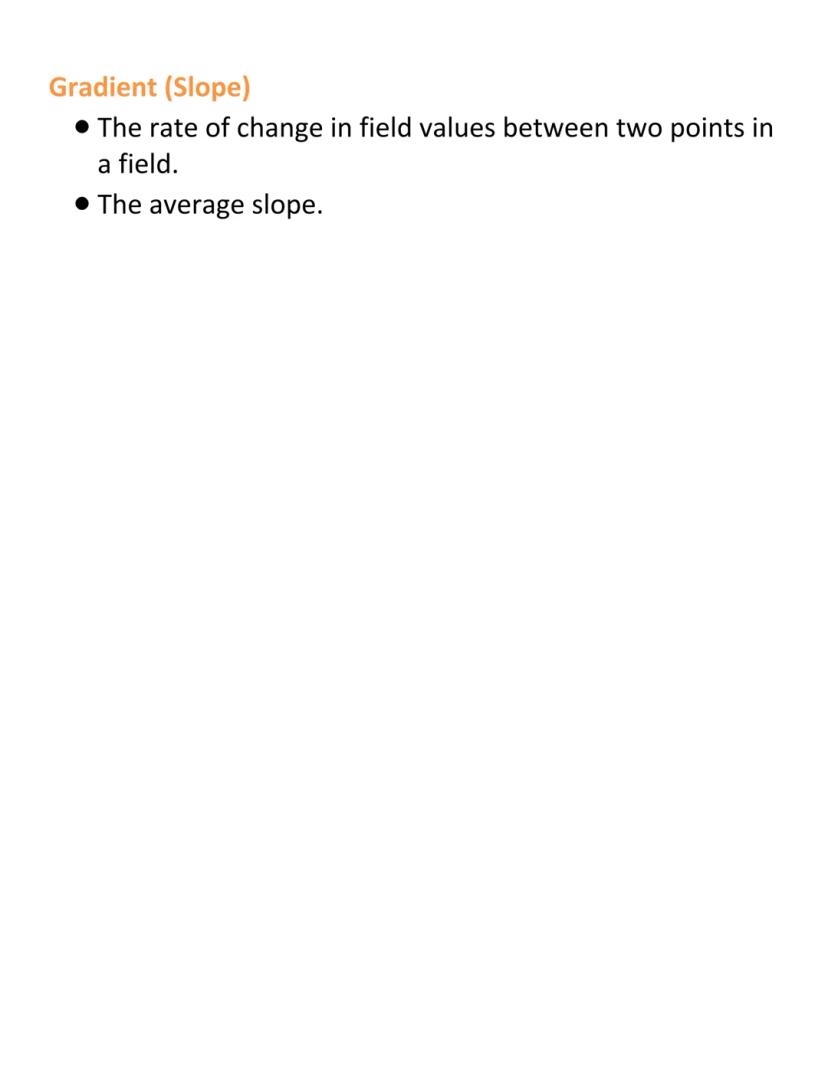
Understanding Gradient
The gradient (also called slope) measures how quickly elevation changes between two points in a field. It tells you how steep the land is—a critical factor for everything from hiking to construction projects.
Calculating gradient is straightforward: divide the vertical change (rise) by the horizontal distance (run). A steep mountain might have a gradient of 1:2 (one unit up for every two units across), while gentle hills have much smaller ratios.
Gradients help engineers design roads, hikers plan routes, and geologists understand erosion patterns. They're essential for understanding how water, wind, and gravity interact with the landscape.
Everyday example: Road signs that warn "10% grade" are telling you the gradient—in this case, the road rises or falls 10 feet for every 100 feet of horizontal distance!
We thought you’d never ask...
Our AI companion is specifically built for the needs of students. Based on the millions of content pieces we have on the platform we can provide truly meaningful and relevant answers to students. But its not only about answers, the companion is even more about guiding students through their daily learning challenges, with personalised study plans, quizzes or content pieces in the chat and 100% personalisation based on the students skills and developments.
You can download the app in the Google Play Store and in the Apple App Store.
That's right! Enjoy free access to study content, connect with fellow students, and get instant help – all at your fingertips.
Similar Content
Most popular content in Environmental Science
8C
Cells
Basics
9th800
Student Exploration: GMOs and the Environment Answer Key.pdf
GMOs and the Environment
4267
Ecology
Gives an overview of Ecological levels of Organization .
1141
Earth and Space: Ch. 2- Minerals
Slideshow about Ch. 2 of Earth and Space Science
11th752
Earth and Space: Ch. 5- Weathering, Soil, and Mass Movements
Slideshow about Ch. 5 of Earth and Space Science
11th1424
Human Impact on the Earth: Effects of Environmental Change on Biodiversity
Very interesting and full of info presentation about human impact on our planet and the biodiversity among the animal species
390
Symbiotic Relationships
Covers: community interactions, mutualism, commensalism, parasitism, habitats, microhabitats, tolerance, ecological niche, keystone species
9th911
Asexual vs Sexual Reproduction
Comparison of advantages and disadvantages of asexual and sexual reproduction, including mitosis and meiosis processes.
9th1547
Most popular content
9O
Origins and Dynamics of the Columbian Exchange
Analyze the ecological and economic motivations behind the initial transfer of goods, people, and diseases between the Old and New Worlds.
9th3,1280
I
Introduction to Early Cultural Interactions
Analyze the initial social and religious encounters between Europeans, Africans, and Indigenous peoples in the colonial Americas.
9th2,7730
O
Origins of Ancient River Civilizations
Analyze the environmental factors and technological innovations that led to the rise of early states in Mesopotamia, Egypt, and the Indus Valley.
9th3,1870
M
Motivations for European Exploration
Analyze the economic, religious, and political factors that drove European powers to the Americas during the 15th and 16th centuries.
9th1,7780
F
Foundations of Ethical Guidelines in Research
Practice the core principles of the APA ethical code including informed consent, debriefing, and the role of Institutional Review Boards.
9th1,3360
I
Introduction to Native American Societies
Examine the diverse social, political, and economic structures of North American indigenous groups prior to European contact.
9th1,1100
I
Introduction to the Spanish Encomienda System
Explore the fundamental economic and social structures of the Spanish colonial system, focusing on the encomienda and the casta social hierarchy.
9th8890
I
Introduction to Biological Elements of Life
Practice identifying the essential elements including carbon, nitrogen, phosphorus, and sulfur that compose biological macromolecules.
9th1,7410
O
Origins of the Articles of Confederation
Practice identifying the motivations for a weak central government and the specific powers granted to the states under the first U.S. constitution.
9th9370
Students love us — and so will you.
4.6/5App Store
4.7/5Google Play
The app is very easy to use and well designed. I have found everything I was looking for so far and have been able to learn a lot from the presentations! I will definitely use the app for a class assignment! And of course it also helps a lot as an inspiration.
Stefan SiOS user
This app is really great. There are so many study notes and help [...]. My problem subject is French, for example, and the app has so many options for help. Thanks to this app, I have improved my French. I would recommend it to anyone.
Samantha KlichAndroid user
Wow, I am really amazed. I just tried the app because I've seen it advertised many times and was absolutely stunned. This app is THE HELP you want for school and above all, it offers so many things, such as workouts and fact sheets, which have been VERY helpful to me personally.
AnnaiOS user
Earth Science Vocabulary Definitions
Donna Costanz@donnacostanz_bbnm
Welcome to the Planet Earth unit! This guide covers essential geographic terms and concepts that help us understand and navigate our planet. You'll learn about Earth's structure, coordinate systems, and how we represent Earth's features on maps.
1
of 6
Sign up to see the content. It's free!
- Access to all documents
- Improve your grades
- Join milions of students
Earth's Structure
Earth isn't a perfect sphere—it's an oblate spheroid, which means it's slightly flattened at the poles and bulges at the equator. Our planet is made up of several major layers that work together as a system.
The lithosphere is the solid outer shell of Earth, including the crust and upper mantle. The hydrosphere covers all of Earth's liquid water—oceans, lakes, rivers, and even groundwater.
Surrounding everything is the atmosphere, the layer of gases enveloping our planet. The lowest layer of the atmosphere is the troposphere, which extends about 12 km up from Earth's surface and contains most of our air and weather.
Fun Fact: The troposphere contains about 75-80% of the atmosphere's total mass, despite being the thinnest atmospheric layer!
2
of 6Sign up to see the content. It's free!
- Access to all documents
- Improve your grades
- Join milions of students
Mapping Earth: Coordinate Systems
Imagine wrapping Earth in a giant grid—that's essentially what a coordinate system does! It gives every location a unique address using the intersection of two lines, typically latitude and longitude.
The equator is the imaginary line circling Earth halfway between the North and South Poles, dividing our planet into northern and southern hemispheres. Latitude measures the angular distance north or south of the equator, from 0° at the equator to 90° at the poles. Lines of the same latitude are called parallels.
Longitude measures east or west of the Prime Meridian (which runs through Greenwich, England), ranging from 0° to 180°. These imaginary semicircles running north-to-south are called meridians.
Remember this: Latitude lines (parallels) run east-west, while longitude lines (meridians) run north-south. Think "latitude is flat-itude" to help remember!
3
of 6Sign up to see the content. It's free!
- Access to all documents
- Improve your grades
- Join milions of students
Special Lines and Navigation
The sun's position creates some important reference lines on Earth. The Tropic of Cancer (23½° north) marks the northernmost point where the sun's rays hit directly overhead during the June solstice. Similarly, the Tropic of Capricorn (23½° south) marks where direct sunlight reaches its southernmost point during the December solstice.
Navigation is how we determine our position on Earth. One navigational measurement is altitude, which tells us how high an object appears above the horizon from our viewpoint.
Time measurement is also connected to Earth's geography. Apparent Solar Time is based on the sun's actual position in the sky and varies slightly from clock time. Solar noon occurs when the sun reaches its highest point in your local sky.
Try this: Next sunny day, notice the sun's position at different times. At solar noon, objects cast their shortest shadow of the day!
4
of 6Sign up to see the content. It's free!
- Access to all documents
- Improve your grades
- Join milions of students
Time and Fields
Greenwich Mean Time (GMT) is based on solar observations along the Prime Meridian, providing a standard reference point for global timekeeping.
When studying Earth, scientists often work with fields—regions where we can measure similar quantities (like temperature or pressure) at every location. To visualize these fields on maps, we use isolines, which connect points of equal value.
Specific types of isolines include isobars (connecting points of equal air pressure) and isotherms (connecting points of equal temperature). These help meteorologists track and predict weather patterns.
Real-world application: Weather forecasters use isolines on maps to show you where temperatures and pressure systems are changing—this helps predict when storms might develop!
5
of 6Sign up to see the content. It's free!
- Access to all documents
- Improve your grades
- Join milions of students
Mapping Elevation
Contour lines are special isolines that connect places with the same elevation, showing the shape of the land. Maps featuring these lines are called topographic maps or contour maps, and they display elevation fields.
The contour interval tells you the elevation difference between adjacent contour lines. A smaller interval (like 10 feet) shows more detail than a larger one (like 100 feet). The pattern of these lines reveals the topography—the shape of the land surface.
When contour lines are close together, they show steep terrain. When they're far apart, the land is relatively flat. By reading these patterns, you can visualize mountains, valleys, and plains without seeing a 3D model.
Map reading tip: When contour lines form a circle with smaller values inside, that's a depression or hole. When they form a circle with higher values inside, that's a hill or mountain!
6
of 6Sign up to see the content. It's free!
- Access to all documents
- Improve your grades
- Join milions of students
Understanding Gradient
The gradient (also called slope) measures how quickly elevation changes between two points in a field. It tells you how steep the land is—a critical factor for everything from hiking to construction projects.
Calculating gradient is straightforward: divide the vertical change (rise) by the horizontal distance (run). A steep mountain might have a gradient of 1:2 (one unit up for every two units across), while gentle hills have much smaller ratios.
Gradients help engineers design roads, hikers plan routes, and geologists understand erosion patterns. They're essential for understanding how water, wind, and gravity interact with the landscape.
Everyday example: Road signs that warn "10% grade" are telling you the gradient—in this case, the road rises or falls 10 feet for every 100 feet of horizontal distance!
We thought you’d never ask...
Our AI companion is specifically built for the needs of students. Based on the millions of content pieces we have on the platform we can provide truly meaningful and relevant answers to students. But its not only about answers, the companion is even more about guiding students through their daily learning challenges, with personalised study plans, quizzes or content pieces in the chat and 100% personalisation based on the students skills and developments.
You can download the app in the Google Play Store and in the Apple App Store.
That's right! Enjoy free access to study content, connect with fellow students, and get instant help – all at your fingertips.
Similar Content
Most popular content in Environmental Science
8C
Cells
Basics
9th800
Student Exploration: GMOs and the Environment Answer Key.pdf
GMOs and the Environment
4267
Ecology
Gives an overview of Ecological levels of Organization .
1141
Earth and Space: Ch. 2- Minerals
Slideshow about Ch. 2 of Earth and Space Science
11th752
Earth and Space: Ch. 5- Weathering, Soil, and Mass Movements
Slideshow about Ch. 5 of Earth and Space Science
11th1424
Human Impact on the Earth: Effects of Environmental Change on Biodiversity
Very interesting and full of info presentation about human impact on our planet and the biodiversity among the animal species
390
Symbiotic Relationships
Covers: community interactions, mutualism, commensalism, parasitism, habitats, microhabitats, tolerance, ecological niche, keystone species
9th911
Asexual vs Sexual Reproduction
Comparison of advantages and disadvantages of asexual and sexual reproduction, including mitosis and meiosis processes.
9th1547
Most popular content
9O
Origins and Dynamics of the Columbian Exchange
Analyze the ecological and economic motivations behind the initial transfer of goods, people, and diseases between the Old and New Worlds.
9th3,1280
I
Introduction to Early Cultural Interactions
Analyze the initial social and religious encounters between Europeans, Africans, and Indigenous peoples in the colonial Americas.
9th2,7730
O
Origins of Ancient River Civilizations
Analyze the environmental factors and technological innovations that led to the rise of early states in Mesopotamia, Egypt, and the Indus Valley.
9th3,1870
M
Motivations for European Exploration
Analyze the economic, religious, and political factors that drove European powers to the Americas during the 15th and 16th centuries.
9th1,7780
F
Foundations of Ethical Guidelines in Research
Practice the core principles of the APA ethical code including informed consent, debriefing, and the role of Institutional Review Boards.
9th1,3360
I
Introduction to Native American Societies
Examine the diverse social, political, and economic structures of North American indigenous groups prior to European contact.
9th1,1100
I
Introduction to the Spanish Encomienda System
Explore the fundamental economic and social structures of the Spanish colonial system, focusing on the encomienda and the casta social hierarchy.
9th8890
I
Introduction to Biological Elements of Life
Practice identifying the essential elements including carbon, nitrogen, phosphorus, and sulfur that compose biological macromolecules.
9th1,7410
O
Origins of the Articles of Confederation
Practice identifying the motivations for a weak central government and the specific powers granted to the states under the first U.S. constitution.
9th9370
Students love us — and so will you.
4.6/5App Store
4.7/5Google Play
The app is very easy to use and well designed. I have found everything I was looking for so far and have been able to learn a lot from the presentations! I will definitely use the app for a class assignment! And of course it also helps a lot as an inspiration.
Stefan SiOS user
This app is really great. There are so many study notes and help [...]. My problem subject is French, for example, and the app has so many options for help. Thanks to this app, I have improved my French. I would recommend it to anyone.
Samantha KlichAndroid user
Wow, I am really amazed. I just tried the app because I've seen it advertised many times and was absolutely stunned. This app is THE HELP you want for school and above all, it offers so many things, such as workouts and fact sheets, which have been VERY helpful to me personally.
AnnaiOS user